
How are bus heartbeats counted?
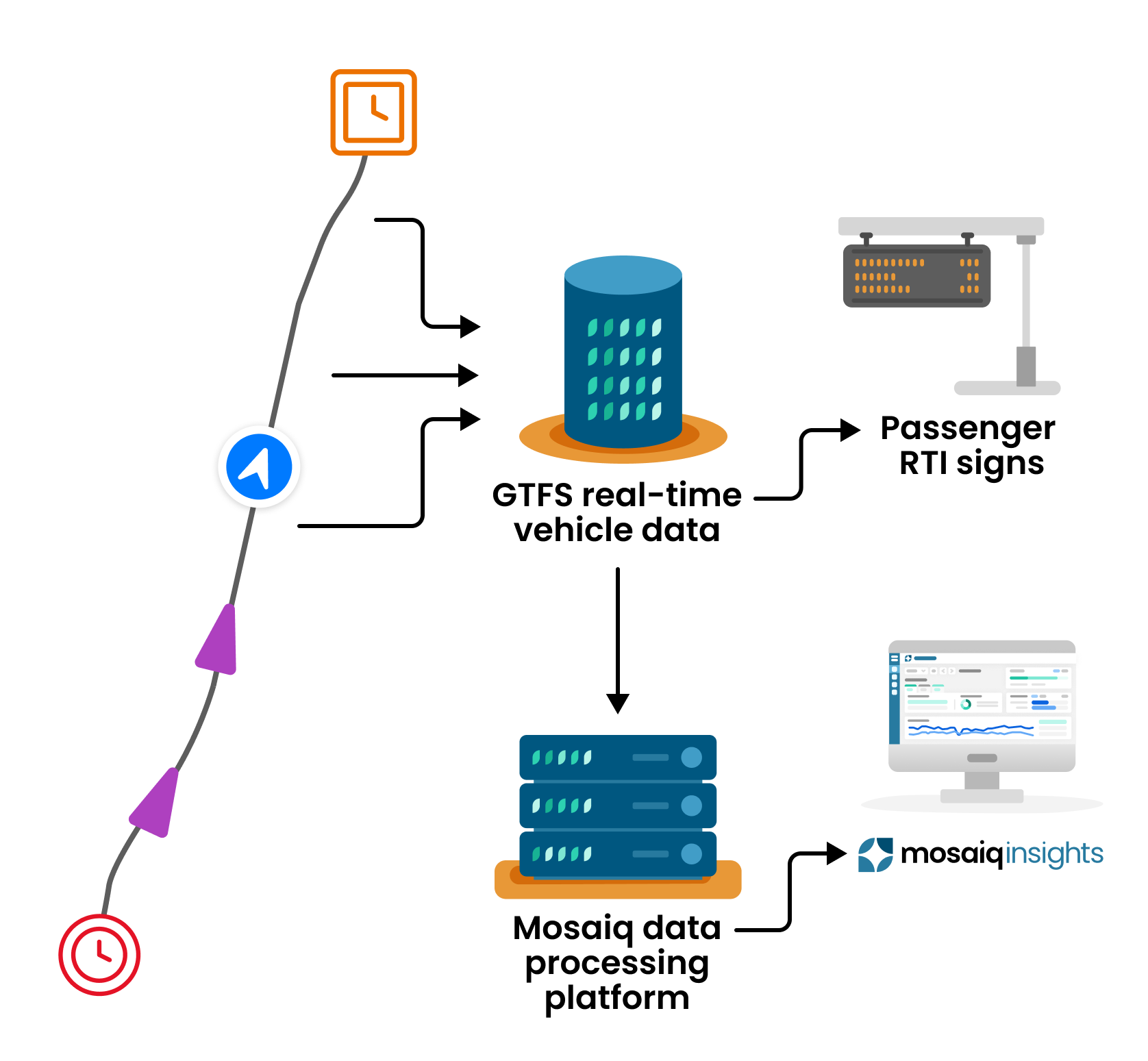
All buses are equipped with GPS equipment which updates the network on the vehicle’s location. The GPS equipment on each bus pings data back to base every few seconds with its location. We call this data ping a heartbeat.
The heartbeat data is used in multiple ways:
RTI panels to update passengers on when bus services are due.
Track how the network is performing to schedule through Mosaiq Insights.
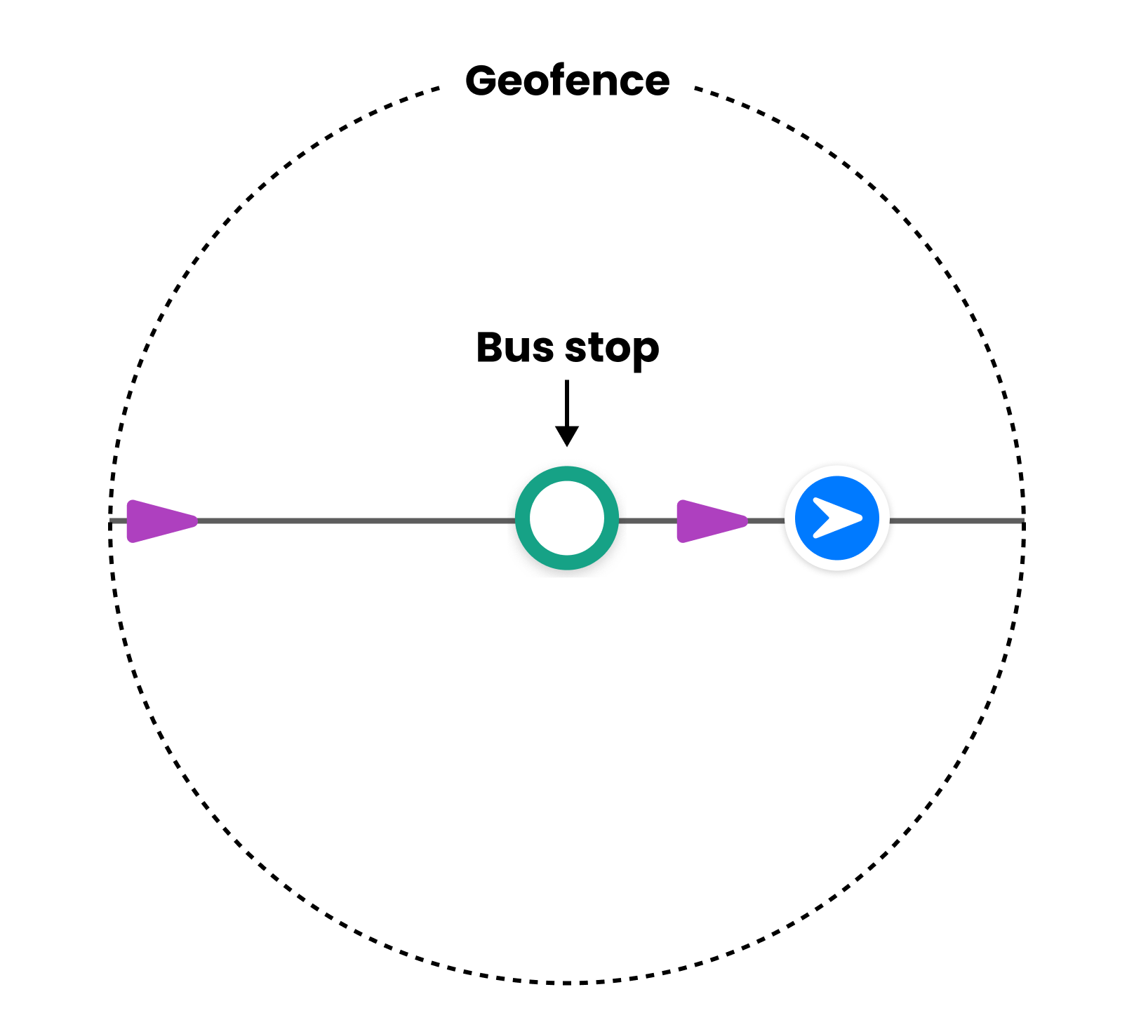
Each bus stop on a network sits at the centre of a geofence. When a bus passes through a geofence, it leaves a trail of heartbeats in the data.
Mosaiq Insights analyses the heartbeat that departs from the stop and compares this to the scheduled time to draw conclusions on whether the bus is early, on-time or late.
There are different rules for calculating the 1st stop which are detailed below.
What is a geofence?
A geofence is a GPS-defined virtual geographic boundary that enables software to trigger a response when a device enters or leaves a specified area.
How is the 1st stop calculated?
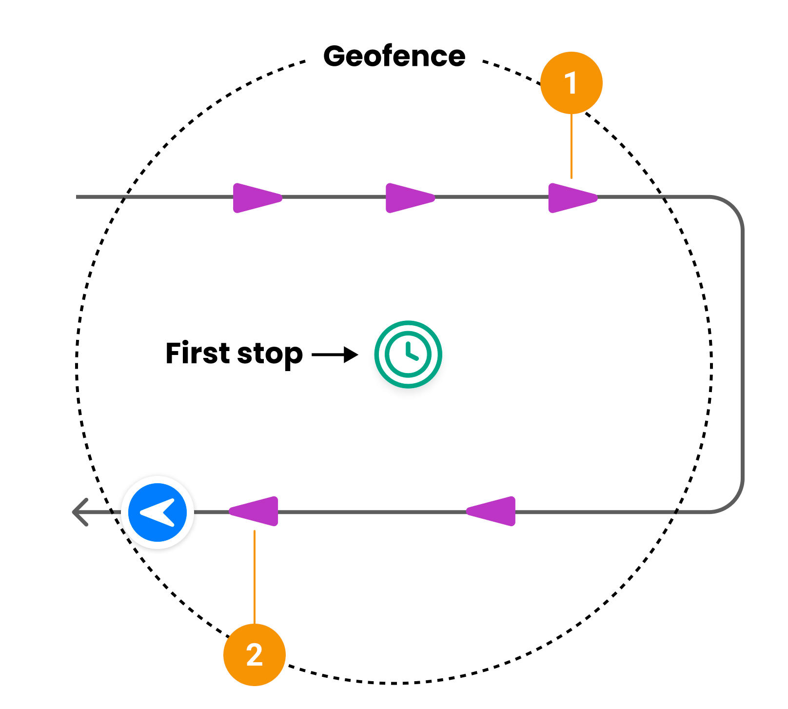
The algorithm for calculating the first stop for a journey is slightly different to account for instances where there are multiple heartbeats that pass through the first stop’s geofence (such as when the vehicle turns around) prior to starting the scheduled journey.
The algorithm now matches the heartbeat that was closest to the scheduled stop time (2) instead of the heartbeat data closest to the stop (1) This has resulted in an uptick in punctuality as more first stops are correctly labelled as on time which would have been early. We understand that there are further improvements as it doesn’t cover all edge cases.
This is in effect within Mosaiq Insights - Beta from the 25th of March 2024 onwards
Dwell time
We determine dwell time by calculating the difference of the time between the arrival heartbeat and depature heartbeat at a stop.
If there is one or no heartbeats within a stops geofence then dwell time will not be calculated.
From the 14 October 2024
Dwell time for the last stop will be “---” before this date it would either be 0 or a time value. Total dwell time for a trip no longer includes the last dwell time stop value in the total